Gallery
We would like to see this gallery become an atlas that illustrates LIP rocks from around the world, and we invite your contributions. If you have a representative, instructive, or scenic photo, please email us a .jpg (along with a figure caption and one or two references).
All contributions will be fully acknowledged.
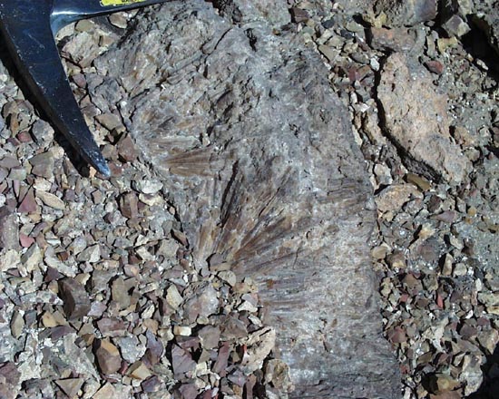
Griffin gabbro sills (2111 Ma, Nunavut, Canada)
Griffin gabbro (2111 Ma) ridge, in middle of photo, forming a sill in south-dipping Paleoproterozoic Hurwitz Group strata, Montgomery Lake, Nunavut, northern Canada. The Griffin gabbro sills may record a mantle plume related to the opening of the Manikewan Ocean, which separated the Superior and Churchill provinces before Trans-Hudson orogenic events. Photo by L.B. Aspler.
see: Aspler, L.B., Cousens, B.L., and Chiarenzelli, J.R., 2002. Griffin gabbro sills (2.11 Ga), Hurwitz Basin, Nunavut, Canada: long-distance intracratonic transport of mafic magmas in western Churchill Province crust. Precambrian Research , 117, 269-294.
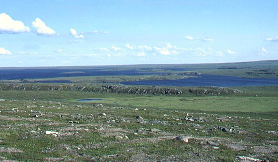
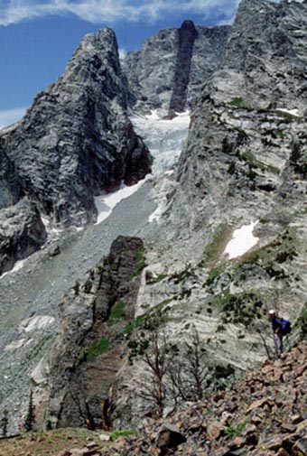
Mackenzie sills (1270 Ma, Northwest Territories, Canada)
Cliff-forming sills, related to the 1270 Ma Mackenzie igneous event, cutting strata of Athapuscow Basin, East Arm of Great Slave Lake, Northwest Territories, Canada. Photo by L.B. Aspler.
see: Baragar WRA, R.E. Ernst, L. Hulbert, T. Peterson, Longitudinal petrochemical variation in the Mackenzie dyke swarm, northwestern Canadian Shield. J. Petrol. 37: 317-359, 1996.
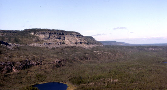
Giles Complex layered gabbro and gabbro-norite (1070 Ma, Hinckley Range, Australia)
Layered gabbro and gabbro-norite series in the Hinckley Range, which is part of the 1070 Ma Giles Complex of the Warakurna LIP (see January 2004 LIP of the month). The photograph looks towards the west, the layers dip to the north. Photo by Franco Pirajno
Moran dyke (780 Ma, Wyoming, USA)
Neoproterozoic mafic dike exposed along the east face of Mount Moran, Teton Range, Wyoming.
Based on paleomagnetism and 40Ar/39Ar geochronology, the dike is considered to be part of the 780 Ma Gunbarrel mafic magmtic event (February 2004 LIP of the month).
At the top of Mount Moran, the dike is nonconformably overlain by the Cambrian Flathead Sandstone.
Photograph by Stephen S. Harlan
See: Harland, S.S., Heaman, L., LeCheminant, A.N., and Premo, W.R., 2003. The Gunbarrel mafic magmatic event: A key 780 Ma time marker for Rodinia plate reconstructions. Geology, 31:1053-1056.
North Mountain basalt (201 Ma, Nova Scotia, Canada)
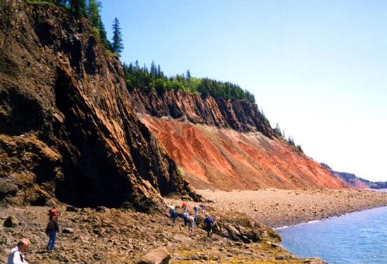
The basal member of the North Mountain basalt (201 Ma, earliest Jurassic) at Economy Mountain at the northern end of the Bay of Fundy, Nova Scotia rests on Late Triassic Blomidon sandstone. A fault has dropped the basalt to a lower level in the foreground. The Tr-J boundary (and mass extinction horizon) lies within the bleached zone just beneath the basalt in the cliff face. The North Mountain basalt group covers the Mesozoic Fundy Basin with more than 6,000 km3 of flows, and it represents a small part of one of the major volcanic events of the northern section of the Central Atlantic Magmatic Province, which extends across at least 10,000,000 km2 within four continents that were later rifted from Pangaea. Photo taken in June of 1999 by J. G. McHone.
Hames, W.E., McHone, J.G., Ruppel, C., and Renne, P., eds., 2003. The Central Atlantic Magmatic Province: American Geophysical Union Monograph 136, 267 p.
Stevens, G.R., 1987. Jurassic basalts of the northern Bay of Fundy region, Nova Scotia, in Roy, D.C., ed., Centennial Field Guide - Northeastern Section: Geological Society of America, v. 5, p. 415-418.
Junction Butte basalt (2.1 Ma, Yellowstone National Park, USA)
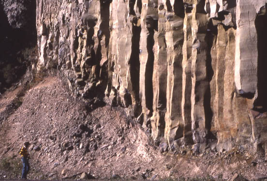
Columnar jointing at base of Junction Butte basalt (2.1 Ma), Yellowstone Plateau volcanic field. The flow overlies fluvial sands and gravels. Yellowstone National Park, USA. Photo by L.B. Aspler.
See Christiansen, R.L., 2001. The Quaternary and Pliocene Yellowstone Plateau Volcanic Field of Wyoming, Idaho, and Montana: U.S. Geological Survey Professional Paper 729-G, 145 p.
Ethiopian-Yemen flood basalts in the Djibouti area
(photos courtesy of Murray Surtees, Managing Director of Green River Geology Co. Pty. Ltd.)
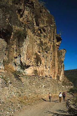
The area is about 90 to 100 km west of the town of Djibouti in Djibouti (former French Somaliland). Here are spectacular NW-trending outcrops of the Ethiopian-Yemen flood volcanism (see January 2005 LIP of the month; Geological Society of America Special paper 352, Menzie et al., 2001, pp. 23-36; and event No. 2 of Ernst and Buchan, 2001, p. 486). This area is geologically poorly known, but its economic potential can be considerable for epithermal style Au-Ag deposits. Here the Green River Geology Company is actively prospecting for gold. Volcanic-rock hosted epithermal gold is usually associated with subduction-related volcanic arc systems (eg Chile, SW Pacific, Indonesia, New Zealand); the presence of epithermal gold in a LIP environment opens new frontiers in mineral exploration.
Afar region; arrow shows approximate location of area;
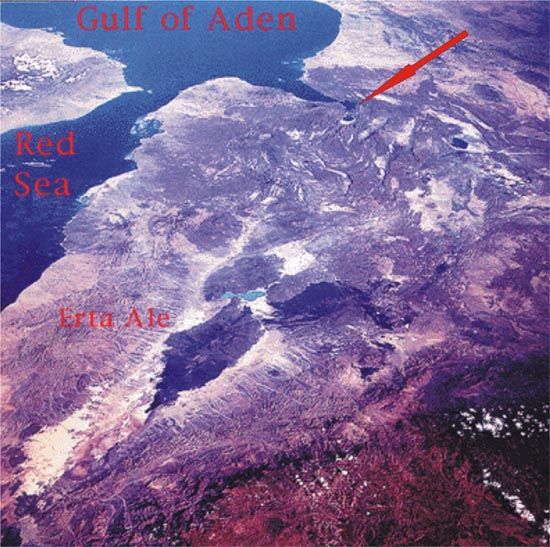
image taken from http://volcano.und.nodak.edu/vwdocs/volc_images/img_afar_region.html
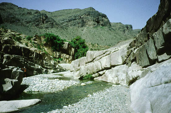
Figure 1a, b and c: Basalt lavas flows (traps)
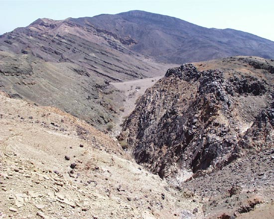
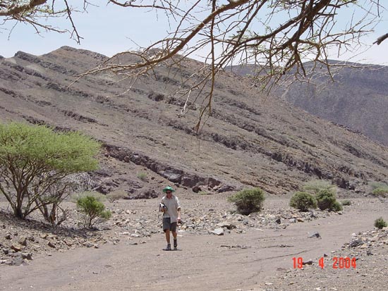
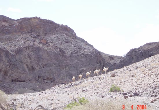
Figure 1d: panoramic of traps country
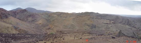
Figure 2: Lac Asal eruptive centre
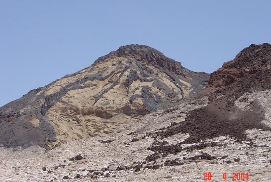
Figure 3: Dome of trachytoid basalt
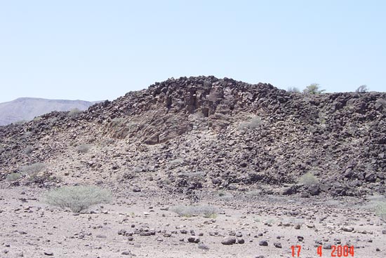
Figure 4: Rhyolite dyke intruding basalt
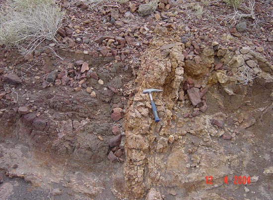
Figure 5: Epithermal sheeted quartz vein system
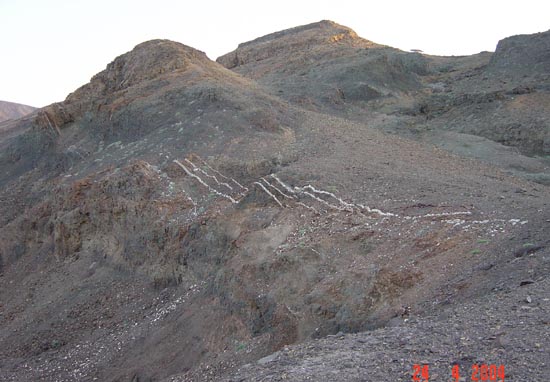
Figure 6: Vein of bladed calcite; the bladed texture is due to CO2-rich boiling fluids, commonly associated with Au mineralisation